![]()

Stonehenge
Stonehenge - Wiltshire, England
Stonehenge is a prehistoric monument located on Salisbury Plain in Wiltshire, England, comprising a circular arrangement of large standing stones within an enclosing ditch and bank approximately 110 metres in diameter. Constructed in multiple phases from around 3000 BC to 1500 BC by Neolithic and early Bronze Age communities, it began as an earthen henge enclosure with 56 Aubrey Holes likely used for timber posts or stones, serving as a cremation cemetery for at least 150 individuals. The defining stone phase around 2500 BC involved erecting massive sarsen stones—sourced locally and averaging 25 tonnes each—in an outer circle of 30 uprights (partially completed) topped by lintels and an inner horseshoe of five trilithons, interspersed with smaller bluestones transported over 200 kilometres from the Preseli Hills in Wales. Later modifications included bluestone rearrangements and the digging of additional pits, reflecting ongoing ceremonial use amid a broader landscape of Neolithic monuments. Archaeological findings highlight its role in burial practices and potential astronomical significance, with the axis aligned to the summer solstice sunrise over the Heel Stone and the winter solstice sunset, though its precise purpose—whether ritual, astronomical observatory, or unifying symbol—continues to be investigated through empirical evidence rather than unsubstantiated legend.
Site Description
Location and Environmental Context
Stonehenge is located on Salisbury Plain in Wiltshire, southern England, approximately 3 kilometers west of Amesbury and 13 kilometers north of Salisbury, at coordinates 51.1788° N, 1.8262° W. The site occupies a portion of the chalk downland characteristic of the region, forming part of the Stonehenge, Avebury and Associated Sites UNESCO World Heritage property, which spans about 2,600 hectares of chalk grassland and arable land. The monument sits at an elevation of roughly 100 meters above sea level on undulating terrain shaped by Cretaceous chalk deposits.
The surrounding environmental context features open chalk downland, a landscape of rolling hills and dry valleys formed by the erosion of underlying chalk bedrock, supporting grassland vegetation adapted to thin, calcareous soils. During the Neolithic period (c. 4000–2500 BC), when Stonehenge was constructed, the area transitioned from partially wooded Mesolithic conditions to more open, cleared land due to human activity, including farming and monument building, with woodland cover estimated to have decreased significantly over time. The site's placement aligns with a broader ceremonial landscape, including the Stonehenge Avenue—a linear earthwork extending nearly 3 kilometers northeast to the River Avon, facilitating ritual connections to water sources approximately 2.5 kilometers away. This riverside proximity underscores the monument's integration into a network of Neolithic sites, such as those in the Stonehenge Riverside complex, emphasizing water's role in prehistoric ritual practices.
Architectural Features and Layout
 Stonehenge's layout centers on a prehistoric earthwork enclosure consisting of a circular ditch and an internal bank, constructed around 3000 BC, with the outer bank largely eroded by ploughing. The enclosure includes two entrances: a wider one to the northeast and a narrower one to the south. Inside the bank lie 56 Aubrey Holes, chalk-filled pits likely used for timber posts, with about half excavated and now marked by concrete discs.
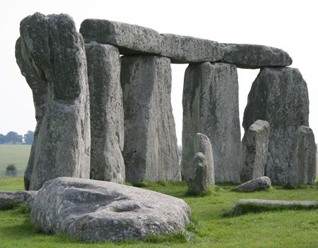
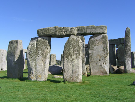
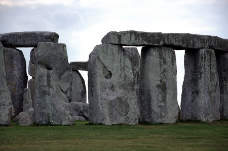
The primary stone architecture comprises sarsen stones—large sandstones averaging 25 tons each—arranged in an outer circle originally of 30 uprights, each supporting lintels, though many are now fallen or missing, forming a ring approximately 30 meters in diameter. Within this, an inner horseshoe of five trilithons—each consisting of two vertical sarsens capped by a lintel—stands prominent, with three fully upright and two partially collapsed; these sarsens were shaped and joined using mortice-and-tenon techniques. Bluestones, smaller igneous rocks weighing 2–5 tons and sourced from Wales, form an inner circle and oval arrangement interspersed among the sarsens, some featuring tenons or grooves indicative of original fittings, though many are fallen, broken, or reduced to stumps.
Additional features include the Altar Stone, a large sandstone slab near the center, mostly buried, and four Station Stones outside the enclosure (two surviving), forming a rectangle. The Heel Stone, an unshaped sarsen weighing about 30 tons, stands outside the northeastern entrance, while the fallen Slaughter Stone lies across the entrance causeway. An avenue, 12 meters wide and marked by parallel banks, extends about 3 kilometers from the northeastern entrance toward the River Avon.
Current Condition and Interventions
Stonehenge currently features approximately 50 of its original stones, with 17 upright sarsen stones forming parts of the outer circle and trilithons, though many have toppled or been damaged over millennia, and some lintels exhibit cracks from weathering and prior interventions. The site's condition reflects both prehistoric collapse and human-induced alterations, including concrete fillings from early 20th-century work that have accelerated deterioration by trapping moisture. Restoration efforts began systematically in the late 19th century, with surveyor William Flinders Petrie conducting the first accurate measurement in 1877, followed by landowner Sir Edmund Antrobus initiating repairs in 1901 to re-erect fallen trilithons. Major interventions occurred between 1919 and 1926 under Colonel William Hawley, who re-erected several stones, excavated extensively, and secured them with concrete, a practice continued into the 1950s and 1960s when further consolidations and excavations stabilized leaning monoliths but introduced incompatible materials. These actions, while preserving visibility, have been critiqued for altering the monument's authentic decay and using cement that exacerbates erosion compared to original stone interfaces. Since the 1980s, English Heritage has shifted to conservation over reconstruction, employing laser surveys and engineering assessments to monitor stability; a key 2021 project repaired deep lintel cracks by removing degraded 1950s cement and applying lime mortar, marking the most substantial work in over 60 years to mitigate further damage without synthetic additives. The site, under English Heritage management since 1983, benefits from UNESCO World Heritage status since 1986, which prompted grassland restoration around the monument starting in 1927 by the National Trust to curb agricultural encroachment. Contemporary interventions address environmental pressures, including proximity to the A303 road; a proposed 1.8-mile tunnel to bury the highway and reduce visual and noise impacts was approved in 2023 but suspended in 2024 and formally cancelled by October 2025 under the Labour government, with plans to revoke development consent to prioritize landscape preservation amid cost overruns exceeding £1.7 billion. Wiltshire Council advanced a Supplementary Planning Document in May 2025, set for potential implementation by October, to safeguard the site from future developments and enhance its setting. Visitor access is regulated, with solstice openings managed to prevent erosion, reflecting ongoing efforts to balance public engagement with structural integrity.
Etymology
Origins of the Name
The name Stonehenge derives from Old English stān henge, combining stān ("stone") with an element related to hengen or hencg, denoting something that hangs or hinges, likely alluding to the monument's lintel stones supported atop uprights in a manner resembling suspended structures or gallows. This descriptive term reflects Anglo-Saxon observation of the site's post-and-lintel architecture, distinct from prehistoric nomenclature, which remains unknown due to the absence of written records from that era. In Middle English usage, stonehenge also denoted a practical device for clamping or hanging stones, underscoring the term's literal connotation of "hanging stones."
The earliest surviving written reference to the name appears in the Historia Anglorum by Henry of Huntingdon, composed around 1130 CE, where it is rendered as Stanenges and described as a marvel featuring "stones of amazing bigness... raised in manner of gateways." This attestation suggests the name circulated orally among Anglo-Saxon speakers prior to the Norman Conquest, possibly as early as the 9th or 10th century, though no earlier textual evidence survives. Alternative medieval designations, such as Geoffrey of Monmouth's Chorea Gigantum ("Giants' Dance") in his Historia Regum Britanniae (c. 1136 CE), represent legendary reinterpretations rather than the etymological root of Stonehenge itself.
Historical and Linguistic Interpretations
 The name Stonehenge originates from the Old English compound stān hencg, literally "stone gallows" or "hanging stones," a descriptive term alluding to the monument's lintel stones, which rest atop upright sarsens in a manner resembling suspended beams or gallows. This etymology first appears in written form as "Stanenges" in Henry of Huntingdon's Historia Anglorum (c. 1130), marking the earliest surviving textual reference to the site and indicating its recognition among Anglo-Norman chroniclers as a prominent ancient structure.
Linguistically, hencg derives from Proto-Germanic roots associated with suspension or pivoting (hanhaną, "to hang"), emphasizing the precarious, elevated positioning of the lintels on tenons carved into the uprights, a feature absent in earlier prehistoric earthworks but distinctive to Stonehenge's megalithic phase. The term "henge," now applied archaeologically to circular enclosures with internal ditches, emerged in the 20th century as a back-formation from Stonehenge itself, retroactively categorizing similar Neolithic monuments like Avebury, though Stonehenge technically lacks the external bank and internal ditch defining true "henge" forms.
Medieval interpretations infused the name with legendary significance, diverging from empirical observation. Geoffrey of Monmouth's Historia Regum Britanniae (c. 1136) reimagines the site as the "Giants' Dance" (Chorea Gigantum), a ring of stones imported from Ireland's Mount Killaraus by the prophet Merlin under King Aurelius Ambrosius to memorialize 460 British nobles betrayed and slain by Saxons at a peace conference. This account, drawing on Welsh oral traditions and classical motifs of druidic stone circles, posits the bluestones' African origins (via Ireland) as healing portals erected by giants, but it conflates disparate archaeological phases and ignores radiocarbon evidence dating construction to 3000–2000 BC, predating any historical Saxon incursions by millennia. Such narratives, while shaping Renaissance antiquarian views, represent pseudohistorical invention rather than verifiable history, as no contemporary records or artifacts support Merlin's involvement or the site's relocation.
Prehistoric Development
Mesolithic and Early Neolithic Activity
Archaeological investigations at the Stonehenge site have uncovered evidence of Mesolithic occupation predating the monument's construction by several millennia, including three large postholes (designated A, B, and C) discovered during excavations in the 1960s within the former visitor car park area. These postholes, measuring up to 1.5 meters in diameter and over 1 meter deep, contained pine charcoal radiocarbon dated to approximately 8000–7000 BC, suggesting the erection of substantial timber structures possibly for ritual or observational purposes aligned with the landscape. A potential fourth posthole has been proposed based on geophysical surveys, though its Mesolithic attribution remains tentative.
In the surrounding landscape, particularly at Blick Mead—a spring-fed site about 1.5 kilometers east of Stonehenge—extensive Mesolithic activity is attested from around 8000–4000 BC, featuring over 100,000 lithic tools, faunal remains indicating feasting on aurochs and other game, and large pit structures interpreted as hunting traps for megafauna. These finds, including the largest known Early Mesolithic pit in northwest Europe (dated circa 10,000 years ago), point to recurrent hunter-gatherer gatherings exploiting the resource-rich Avon River valley, with the Stonehenge plateau potentially forming part of a peninsula-like environment conducive to such seasonal occupations. However, direct Mesolithic artifacts at the precise Stonehenge location are absent, limiting interpretations of the postholes to symbolic or practical timber monuments rather than sustained settlement.
The transition to the Early Neolithic around 4000 BC brought agricultural practices to southern Britain, with pollen records from the Stonehenge region indicating initial woodland clearance and the establishment of grassland for pastoralism and rudimentary cultivation, marking a shift from foraging economies. Genetic evidence from Neolithic burials confirms that early farmers in the area descended primarily from Anatolian migrants who introduced domesticated crops, livestock, and megalithic traditions via maritime routes from continental Europe, replacing much of the indigenous Mesolithic population through demographic expansion rather than violence. Pits and scatters of early Neolithic pottery and tools in the vicinity suggest opportunistic use of the site for resource processing, though no permanent structures are known until the later phases of monument building circa 3100 BC. This period laid the groundwork for intensified land use, with the arrival of farming enabling population growth that facilitated subsequent ceremonial developments.
Initial Monument Construction (c. 3100–2900 BC)
 The initial phase of Stonehenge's construction, dated to circa 3100–2900 BC through radiocarbon analysis of antler tools and organic remains, involved the excavation of a large circular ditch approximately 110 meters in diameter and up to 2 meters deep, utilizing red deer antler picks as evidenced by archaeological finds within the fill. The chalk spoil from the ditch was heaped externally to form a bank about 1.8 meters high, creating a classic henge monument with a single entrance oriented northeast, aligned with the solstice sunrise as indicated by the causeway preserving an unbroken circuit. This earthwork enclosure enclosed an area of roughly 1.2 hectares, with the ditch's V-shaped profile suggesting manual labor by organized Neolithic communities employing simple digging technology.
Set just inside the inner edge of the bank were 56 chalk-filled pits known as the Aubrey Holes, each measuring about 1.2 meters in diameter and depth, identified through early 20th-century excavations and geophysical surveys. Excavations revealed cremated human bone fragments in approximately 60% of the Aubrey Holes examined, with radiocarbon dates for these remains clustering around 3030–2880 BC, contemporaneous with the ditch digging, indicating the pits served as repositories for funerary practices involving over 50 individuals. While some Aubrey Holes show evidence of recutting or packing with stones in later phases, their primary Neolithic function remains debated, with archaeological consensus leaning toward initial use as post sockets for timber uprights or bluestone markers, though direct evidence for posts is limited to organic traces now decayed. The precise arrangement and purpose of these holes underscore the monument's early role in ritual or ceremonial activity, distinct from the later megalithic phases.
Major Megalithic Phases (c. 2600–1600 BC)
 The primary megalithic construction at Stonehenge commenced around 2500 BC with the erection of massive sarsen sandstones, forming the monument's dominant architectural features. These included an outer circle of approximately 30 upright sarsen stones, each averaging 4.1 meters (13 feet) high and weighing about 25 tons, topped by 30 lintel stones secured using mortise-and-tenon and tongue-and-groove joints to create a continuous ring roughly 33 meters (108 feet) in diameter. Within this circle, five trilithons—pairs of uprights capped by lintels—were arranged in an open horseshoe shape spanning about 14 meters (45 feet) across, with the central trilithon being the largest at up to 50 tons per stone. Archaeological evidence, including shaped stone debris and antler tools radiocarbon-dated to 2310–2200 BC, supports this phase's timing during the late Neolithic.
Concurrently or shortly thereafter, smaller bluestones, previously erected in arcs within Q and R Holes around 2600–2400 BC, were integrated and rearranged into a double arc between the sarsen elements, alongside the raising of four Station Stones in a rectangle outside the circle and additional sarsens near the northeastern entrance, including the Heel Stone. The stones were dressed using hammerstones, with finer finishing on exposed faces, and erected via sloped pits, ropes, and timber levers, demonstrating advanced Neolithic engineering.
Subsequent modifications around 2300–2200 BC involved further bluestone rearrangements into an inner circle and oval, later altered to a horseshoe within the trilithons, refining the monument's internal configuration over centuries. By 1800–1500 BC, two incomplete rings of pits (Y and Z Holes) were dug around the existing settings, likely intended for additional bluestones, as indicated by radiocarbon-dated antler picks and stone fragments within them, marking the final major activity before the Bronze Age transition. These phases reflect sustained investment in the site's elaboration, with Bayesian modeling of radiocarbon data confirming the overall chronology from 2600 to 1600 BC.
Post-Construction Prehistoric Use
Following the major megalithic phases concluding around 1600 BC, Stonehenge transitioned to a period of primarily non-constructive prehistoric use, marked by ceremonial and mortuary activities during the Bronze Age. One of the final construction efforts involved excavating two incomplete rings of pits known as the Y and Z holes around the outer stone settings, dated between 1800 and 1500 BC and left unfilled, suggesting an aborted attempt to rearrange or add stones.
During the middle Bronze Age, the sarsen stones were incised with petroglyphs depicting bronze flanged axes and daggers, including examples resembling Arreton Down type artifacts from 1750–1500 BC, totaling over 70 such carvings discovered by 2005. These engravings, executed after the stones' erection, reflect the monument's enduring ritual role amid the adoption of metalworking technologies, possibly symbolizing offerings or commemorating elite status.
The surrounding Stonehenge landscape witnessed intensive barrow construction in the early Bronze Age, from circa 2400 to 1600 BC, with one of Britain's highest concentrations—over 300 round barrows within a two-mile radius—many containing cremations, inhumations, and rich grave goods like metal objects. Barrow groups often aligned with the monument, indicating Stonehenge functioned as a focal point for ancestral cults, processions, and mortuary rituals, integrating Neolithic traditions with incoming Beaker culture practices.
Archaeological traces of Bronze Age activity at the monument itself include scattered pottery shards, food remains like hazelnuts and cereals suggesting feasting, and continued deposition of human remains, underscoring sustained ceremonial use without further monumental building. By approximately 1500 BC, the site's prominence waned as regional focus shifted, though evidence of sporadic prehistoric visitation persisted into the Iron Age.
Builders and Genetic Evidence
Archaeological Traces of the Constructors
 The principal archaeological traces of Stonehenge's constructors derive from Durrington Walls, a Neolithic henge enclosure and associated settlement located approximately 3 kilometers northeast of the monument, radiocarbon dated to 2600–2500 BC and contemporaneous with the erection of the site's massive sarsen stones. Excavations conducted as part of the Stonehenge Riverside Project, led by archaeologist Mike Parker Pearson, uncovered evidence of domestic occupation, including eight houses with six featuring well-preserved clay floors, each measuring about 5 meters square and containing central hearths, postholes, and slots indicative of wooden furniture or partitions. These structures, along with adjacent rubbish pits filled with pottery shards, flint tools, and animal bones, suggest a temporary or seasonal community capable of supporting large-scale construction labor, though only a limited number of houses have been directly excavated, tempering claims of a vast urban-like settlement.
Abundant faunal remains at Durrington Walls, primarily from pigs and cattle slaughtered in midwinter and showing signs of long-distance transport via isotopic analysis of tooth enamel, point to organized feasting events that likely gathered workers from broader regions, facilitating the communal effort required for hauling and positioning megaliths weighing up to 50 tons. A 30-meter-wide avenue, extending 170 meters from the settlement to the River Avon, parallels the stone-lined avenue at Stonehenge itself, implying ritual processions or logistical pathways connecting the "domain of the living" at Durrington to the ancestral monument.
In 2020, geophysical surveys revealed a vast circuit of over 20 shafts encircling Durrington Walls, forming a 2-kilometer-diameter ring with individual pits up to 10 meters in diameter and 5 meters deep, constructed by Neolithic communities around 2500 BC. These features, confirmed by targeted excavation, may have demarcated a sacred or territorial boundary for the builder population, distinguishing their domain from Stonehenge and underscoring a structured social organization with symbolic landscaping on a monumental scale.
Adjacent sites like Woodhenge, marked by concentric postholes for timber uprights dated to the same period, yield further traces of activity, including offerings of food and ceramics in post settings, hinting at ceremonial construction practices akin to those at the stone circle. Collectively, these findings indicate that Stonehenge's builders operated from nearby bases rather than on-site encampments, with evidence pointing to episodic, labor-intensive occupations rather than continuous habitation, consistent with the monument's multi-phase development over centuries.
DNA Analyses and Population Insights
 Ancient DNA analyses of Neolithic human remains from Britain, dating to approximately 4000–2500 BC, indicate that the population responsible for the initial construction phases of Stonehenge descended primarily from Early European Farmers originating in Anatolia, with migration occurring via a western route through the Mediterranean and Iberia rather than central Europe. This genetic profile, characterized by high levels of ancestry from Anatolian Neolithic groups and minimal Mesolithic hunter-gatherer input (less than 10% in most individuals), shows uniformity across southern Britain, including sites near Stonehenge such as those in the Avebury region. Comparative genomic data from 67 Neolithic skeletons reveal closest affinities to Iberian Neolithic populations, supporting a model of sustained gene flow from the western Mediterranean arc into Britain around 6000–4000 BC, displacing indigenous hunter-gatherers.
Direct DNA extraction from the Aubrey Holes at Stonehenge—containing cremated remains dated to circa 3100–2900 BC—has proven challenging due to the fragmentary nature of the bones, but proxy evidence from contemporaneous Neolithic burials in the region aligns with this broader farmer ancestry. Isotope and genetic studies of nearby long barrows and cursuses confirm that these early monument builders practiced a mixed economy of farming and herding, with dietary stable isotope ratios indicating reliance on domesticated cereals and livestock, consistent with continental Neolithic traditions.
By the mid-third millennium BC, coinciding with the major megalithic phases of Stonehenge (circa 2600–2400 BC), genomic data from early Bronze Age burials around the monument reveal a dramatic shift: the arrival of Bell Beaker-associated individuals introduced substantial steppe pastoralist ancestry (Yamnaya-related), linked to migrations from the European continent around 2450 BC. This event resulted in a near-total population replacement, with Neolithic farmer-derived genomes dropping to less than 10% in subsequent generations, as evidenced by analysis of over 150 individuals showing Y-chromosome haplogroup R1b dominance and autosomal steppe admixture exceeding 90% by 2000 BC. Burials near Stonehenge, such as those at Amesbury Down and Winterbourne Stoke, exhibit close genetic kinship among Beaker folk, suggesting kin-based groups contributed to later modifications or uses of the site, though the core Neolithic genetic substrate persisted minimally in the local gene pool. These findings underscore a causal discontinuity in Britain's population history, where cultural continuity in monument-building masked profound genetic turnover, potentially driven by migration, competition, or demographic collapse rather than gradual admixture.
Materials and Engineering
Stone Types and Provenance
Stonehenge consists primarily of two distinct categories of megaliths: the larger sarsen stones and the smaller bluestones, with the Altar Stone representing a unique third type. The sarsens, comprising the outer circle, inner horseshoe, and lintels, are blocks of silcrete sandstone averaging around 25 tons, though some trilithon uprights exceed 30 tons. Geochemical analyses, including mineralogical and isotopic profiling of stone fragments, indicate that these sarsens originated from West Woods on the Marlborough Downs, approximately 25 kilometers north of the site in Wiltshire. This provenance was confirmed through comparisons of quartz grain morphology, rare earth element signatures, and strontium isotope ratios matching local erratic deposits rather than more distant sources.
The bluestones, numbering around 80 originally and forming the inner oval and circle, are igneous and volcanic rocks such as spotted dolerites, rhyolitic tuffs, and foliated rhyolites, typically weighing 1–5 tons. Petrographic and geochemical studies, including U-Pb dating of zircons and whole-rock chemistry, trace most bluestones to specific outcrops in the Preseli Hills of Pembrokeshire, west Wales, over 220 kilometers distant. Excavations at quarries like Carn Goedog and Craig Rhos-y-felin have uncovered extraction pits, debitage, and tools dated to circa 3000 BC, supporting human quarrying and transport rather than glacial deposition as the primary mechanism. Not all bluestones match Preseli exactly; a few, such as certain tuffs, show affinities to other Welsh or Devonian sources, but the dominant assemblage aligns with northern Preseli outcrops.
The Altar Stone, a 5-meter-long recumbent sandstone slab in the center, differs markedly as an orthoquartzite derived from Devonian Old Red Sandstone. A 2024 study using portable X-ray fluorescence and automated mineralogy identified its detrital zircon populations and heavy mineral suites as matching northeast Scottish deposits, likely from the Orcadian Basin near Inverness or Orkney, over 600 kilometers away—the farthest provenance at Stonehenge. This challenges earlier Anglo-Welsh hypotheses and implies exceptional transport logistics, possibly via sea routes along Britain's eastern coast. Minor stone types, including calcreted sands and imported hammerstones, appear in the monument but play secondary roles in its structure.
Transportation and Erection Techniques
The sarsen stones, weighing up to 50 tonnes each, were quarried from West Woods approximately 25 kilometres north of Stonehenge and transported overland, likely using wooden sledges, rollers, and ropes pulled by teams of oxen or humans. Experimental archaeology has demonstrated that groups of 100-200 people could move such monoliths at rates of about 2 kilometres per day on prepared tracks, aligning with the labour-intensive capabilities of Neolithic communities.
The smaller bluestones, sourced from multiple quarries in the Preseli Hills of west Wales over 200 kilometres away, were extracted using stone wedges and hammerstones to split orthostats from bedrock outcrops, as evidenced by in-situ tools at sites like Carn Goedog and Craig Rhos-y-felin. Recent geochemical and mineralogical analyses, including a 2025 study of the Newall boulder, confirm human transport rather than glacial deposition, with no supporting evidence for ice movement despite past hypotheses. Transport routes may have involved coastal rafting followed by overland hauling, or direct land routes with sledges, facilitated by organized groups leveraging oxen, as indicated by isotopic analysis of cattle teeth from contemporaneous sites suggesting long-distance herding. For the Altar Stone, its Scottish sourcing implies networked transport, potentially via coastal routes combining sledges, rollers, and waterways, though experimental replications indicate teams of hundreds could manage such distances over generations.
Erection involved excavating deep pits—up to 2 metres wide and 1.5 metres deep for sarsens—into which stones were manoeuvred using earthen ramps and levers, then tilted upright with A-frame counterweights, ropes, and packing of smaller stones or chalk rubble for stability. Lintels were shaped with stone mauls and positioned atop uprights via mortise-and-tenon joints, secured further by tongue-and-groove interlocking, requiring coordinated teams of hundreds over extended periods, as inferred from tool marks and pit stratigraphy. Direct archaeological evidence for these techniques is limited to quarry tools and structural analysis, but replication experiments validate their feasibility with Bronze Age technology.
Recent Sourcing and Transport Discoveries
In 2020, geochemical analysis using portable X-ray fluorescence spectrometry on core fragments from a fallen sarsen trilithon and other samples identified West Woods in Wiltshire, approximately 25 kilometers north of Stonehenge, as the probable source for the majority of the monument's sarsen stones, which weigh up to 30 tons each. This finding resolved a long-standing question about local provenance, as the sarsens' silica-cemented sandstone matched the mineralogical and chemical signature of buried sarsen boulders in West Woods, distinguishing it from other regional sources.
For the smaller bluestones, excavations between 2011 and 2015 at quarries such as Craig Rhos-y-felin and Carn Goedog in the Preseli Hills of southwest Wales confirmed these as primary sources, with radiocarbon dating of associated charcoal and sediment placing quarrying activity around 3000 BC, contemporaneous with early monument phases. Multiple quarry sites yielded evidence of pillar extraction techniques, including wooden wedges to split orthostats up to 2 meters long, supporting targeted selection of dolerite and rhyolite varieties transported over 200 kilometers. The Altar Stone, a distinct recumbent sandstone slab over 5 meters long, was traced in 2024 via U-Pb dating and isotopic fingerprinting to the Orcadian Basin in northeast Scotland, approximately 660 kilometers away, marking the farthest confirmed sourcing distance and challenging prior assumptions of a Welsh origin.
Recent transport studies have increasingly favored human agency over glacial deposition, particularly for bluestones. In July 2025, strontium isotope analysis of the "Newall boulder"—a bluestone fragment excavated in 1924—revealed a West Wales provenance inconsistent with local Salisbury Plain geology, indicating deliberate prehistoric conveyance rather than Ice Age erratics. This aligns with quarry evidence of organized extraction but contrasts with persistent glacial hypotheses, which lack direct erratics matching Stonehenge's specific lithologies in the region. Isotope analysis in August 2025 of a Neolithic cow's third molar tooth, found near Stonehenge's south entrance and dated to around 3000 BC, showed the animal originated in Paleozoic bedrock areas like the Preseli Hills, suggesting cattle herding facilitated migration or logistics for stone movement from Wales. For the Altar Stone, its Scottish sourcing implies networked transport, potentially via coastal routes combining sledges, rollers, and waterways, though experimental replications indicate teams of hundreds could manage such distances over generations. These discoveries underscore causal human effort in material procurement, with ongoing debate on precise mechanisms like overland traction versus sea voyages for bluestones.
Function and Purpose Debates
Evidence for Astronomical and Calendrical Roles
The primary astronomical alignment at Stonehenge involves the monument's central axis, which points toward the sunrise at the summer solstice and the sunset at the winter solstice. This solstice axis is marked by the Avenue, a processional way extending from the entrance, aligning with the Heel Stone positioned approximately 77 meters northeast of the center. Observers at the monument's center witness the sun rising directly behind the Heel Stone on the summer solstice around June 21, a phenomenon observable today and retroactively calculable for the Neolithic period circa 2500 BC.
The Station Stones, four surviving markers at the corners of a rectangle enclosing the henge, further delineate this solstice axis, with their positions tangent to the sarsen circle and aligned to solstice extremes. Archaeological consensus accepts these solar alignments as intentional, though of modest precision due to the monument's scale and prehistoric surveying limitations, distinguishing them from modern precise observatories. Empirical verification comes from direct observation and computational modeling of prehistoric solar positions, confirming the alignments hold within a few degrees over millennia.
Lunar alignments represent a more contested aspect, with proposals linking Stonehenge to the moon's 18.6-year major standstill cycle, during which moonrise and moonset reach their northernmost and southernmost extremes. The Station Stones and certain trilithons may align with these lunar positions, as suggested by archaeoastronomers analyzing sightlines from the monument's phases. Recent studies during the current standstill cycle (peaking around 2024-2025) aim to test these via photographic and laser surveys, but evidence remains circumstantial, lacking direct artifacts indicating lunar observation practices.
Gerald Hawkins' 1960s computer analyses posited the 56 Aubrey Holes as a predictive device for lunar eclipses, simulating marker movements to track the 18.6-year lunar nodal cycle and Saros eclipse period. This "Neolithic computer" theory gained attention through calculations showing eclipse forecasting potential but faced criticism for assuming unattested stone-moving rituals and overinterpreting hole counts without supporting archaeological context. Subsequent evaluations, including by astronomers like Fred Hoyle, refined but did not substantiate the eclipse mechanism, viewing it as speculative amid alternative explanations for the holes, such as timber posts or cremation pits.
Calendrical functions, such as encoding a 365-day solar year, have been proposed based on sarsen stone numerology—e.g., 30 sarsen lintels for 12 months of 30 days plus adjustments—but these rely on numerological assumptions rather than empirical usage evidence. Critics argue such interpretations impose modern calendrical concepts on prehistoric practices, ignoring inconsistencies like unequal months and lack of intercalation markers, favoring ritual or burial primacy over timekeeping precision. No verifiable artifacts or comparative Neolithic calendars support Stonehenge as a functional perpetual calendar, though solstice markers could have aided seasonal timing for agriculture or ceremonies.
Ritual, Burial, and Social Functions
Archaeological excavations have uncovered evidence of extensive cremation burials at Stonehenge, primarily dating from approximately 3000 to 2500 BC during the monument's early phases. Over 50,000 fragments of cremated human bone representing at least 63 individuals have been analyzed, with deposits found in the Aubrey Holes, the ditch, and other locations around the site. Strontium isotope analysis of tooth enamel from these remains indicates that some individuals originated from regions as far as west Wales, over 140 miles away, implying the transport of cremated ancestors over long distances for interment, which points to the site's role as a focal point for commemorative practices. This pattern persisted for at least 500 years, suggesting Stonehenge functioned as a cemetery for select deceased, possibly elites or lineage founders, rather than a general population burial ground.
Ritual activities are inferred from associated deposits and nearby sites linked to Stonehenge's use. Pits and the enclosing ditch contain structured deposits of animal bones (primarily pig, sheep, and cattle), pottery, and flint tools, consistent with ceremonial offerings or terminations of rituals. Evidence of large-scale feasting, particularly at Durrington Walls—a contemporaneous settlement 1.5 miles northeast—includes vast quantities of pig and cattle remains, with isotopic data showing animals were herded from across southern Britain, up to 100 miles away, for midwinter gatherings that may have complemented Stonehenge's midsummer observances. These feasts involved slaughter and consumption on a scale requiring seasonal assembly of hundreds, likely tied to ancestral veneration or seasonal rites, as pottery residues indicate cooking of pork, beef, and dairy products in communal settings.
Social functions of Stonehenge are evidenced by the organizational demands of its construction and use, which required coordinated labor from a stratified Neolithic society. Erecting the monument's phases involved quarrying, transporting, and positioning stones weighing up to 50 tons, necessitating thousands of workers seasonally mobilized through social networks, possibly under chiefly or kin-based leadership to manage logistics without evidence of coercion or slavery. Feasting and burial practices suggest the site served to reinforce social bonds, with gatherings drawing diverse groups for shared rituals that may have facilitated alliance-building or status display among regional polities. The selective nature of burials and scale of events indicate emerging hierarchies, where control over monumental works and ancestral remains conferred prestige, though direct evidence of inequality remains limited to osteological variations in remains showing physical stress from labor.
Unification and Acoustic Theories
The unification theory posits that Stonehenge served as a monument to foster cohesion among disparate Neolithic and early Bronze Age communities across Britain, particularly amid migrations from continental Europe around 2500 BCE. This hypothesis gained support from the 2024 geological analysis revealing that the site's central "altar stone," weighing approximately 5 tons, originated from the Orcadian Basin in northeast Scotland, over 700 kilometers distant, marking the farthest-sourced material at the monument. Combined with bluestones quarried from Preseli Hills in Wales (about 200 kilometers away) and sarsen stones from local Marlborough Downs (under 30 kilometers), the diverse provenances indicate coordinated efforts spanning Britain's length, suggesting elite-driven projects to symbolize shared identity during a period of cultural upheaval, including the arrival of Beaker folk introducing metallurgical innovations and single-grave burials.
Proponents, led by archaeologist Mike Parker Pearson, argue this reflected a response to social tensions or a "legitimation crisis" as incoming groups challenged indigenous farming populations, with the monument's construction—spanning phases from circa 3000 to 2000 BCE—potentially rallying regional polities through communal labor and feasting, evidenced by nearby Durrington Walls' remains of pig bones from multiple locales. However, the theory remains interpretive, as direct evidence of unified governance is absent; stone transport implies cooperation but not necessarily lasting political integration, and subsequent cultural fragmentation, including Bell Beaker dominance, suggests any unification may have been transient or symbolic rather than structurally enduring.
Acoustic theories propose that Stonehenge's design amplified and resonated sounds, potentially enhancing rituals involving music, speech, or percussion for communal or ceremonial purposes. Empirical studies using 1:12 scale models and computational simulations demonstrate that the bluestones, composed of dolerite and rhyolite, exhibit bell-like ringing when struck—frequencies around 145 Hz for larger examples—while the enclosing sarsen circle created focused reflections, boosting voice projection by up to 10 decibels and generating short reverberation times (under 0.5 seconds) suitable for rhythmic chanting or drumming without muddling overtones. These properties, quantified in 2020 research, align with Neolithic instrument capabilities, such as animal-skin drums or bone flutes, and suggest auditory effects contributed to the site's experiential impact, possibly evoking ancestral or supernatural presence during solstice gatherings.
Such acoustics, while verifiable through physical modeling, do not confirm intentional design for sound; natural stone properties and geometric arrangements could yield these effects coincidentally, with no artifacts directly linking prehistoric use to sonic rituals, though ethnographic parallels from other megalithic cultures support speculation of sound in shamanic practices. Further simulations indicate enhanced low-frequency propagation across the monument's diameter, aiding group synchronization in open-air settings, but claims of Stonehenge as a "stone tape" for recording events or advanced acoustic engineering exceed empirical bounds, rooted instead in unverified pseudoscientific narratives.
Evaluation of Fringe and Speculative Claims
One prominent fringe claim posits that Stonehenge was constructed by ancient Druids as a site for rituals or sacrifices, a notion popularized in 17th- and 18th-century antiquarian writings drawing on Roman accounts of Celtic practices. This theory lacks empirical support, as radiocarbon dating places Stonehenge's primary phases between approximately 3000 BCE and 2000 BCE, predating the emergence of Druidic traditions by over a millennium; Druids are associated with the Iron Age Celts from around 800 BCE onward, with no archaeological evidence linking them to the monument's erection or use. The persistence of this association stems from medieval folklore, such as Geoffrey of Monmouth's 12th-century attribution to the wizard Merlin, rather than material evidence, and modern neo-Druidic gatherings at the site represent a 20th-century revival unconnected to prehistoric builders.
Another speculative assertion, advanced by authors like Erich von Däniken in works such as Chariots of the Gods? (1968), suggests extraterrestrial beings constructed Stonehenge due to the perceived impossibility of prehistoric humans transporting and erecting its massive sarsen and bluestones. This claim relies on underestimating Neolithic engineering capabilities, ignoring evidence from quarry sites, tool marks, and experimental archaeology demonstrating human methods like sledges, rollers, and levers for stone movement over land and water; for instance, bluestones sourced from Wales show deliberate selection and transport feasible with organized labor forces of hundreds. No artifacts, inscriptions, or anomalous materials indicative of advanced non-human technology have been found at the site, and the theory violates Occam's razor by invoking unverified extraterrestrial intervention where human agency suffices, as corroborated by successive excavations revealing incremental construction phases by local populations.
The idea of Stonehenge as a prehistoric healing center or "Lourdes," proposed by archaeologists Timothy Darvill and Geoffrey Wainwright based on the presence of individuals with injuries or deformities in cremated remains and the bluestones' supposed medicinal folklore, ventures into speculation without causal evidence tying the site primarily to therapy. While isotopic analysis of teeth from burials indicates some visitors traveled from afar, potentially seeking remedies, the majority of interments reflect local elites rather than a broad pilgrim population, and no residues, tools, or structures support medical practices; the bluestones' "healing" lore originates from medieval texts, not prehistoric contexts, rendering the hypothesis an interpretive overreach akin to projecting modern wellness pseudoscience onto ambiguous skeletal data.
Additional fringe notions, such as acoustic levitation using stone resonances to transport megaliths or the site functioning as a UFO portal, derive from New Age interpretations of sound experiments and ley line alignments but contradict physics and geology; bluestone lithophones produce tones, yet no experimental replication achieves levitation, and alignments reflect basic solar observations common to many prehistoric sites rather than interdimensional gateways. These claims prioritize anecdotal mysticism over verifiable data, often emerging from 20th-century pseudohistory that fills evidential gaps with untestable assertions, while established findings—including DNA from builders showing continuity with regional farmers—affirm Stonehenge as a product of human societal complexity without invoking supernatural or alien aids.
Post-Prehistoric History
Bronze Age to Roman Period Interactions
Following the Neolithic construction phases of Stonehenge, the early Bronze Age (c. 2400–1500 BC) witnessed the erection of numerous round barrows in the surrounding landscape, creating one of Britain's densest concentrations of such monuments. These barrows functioned primarily as burial sites, with archaeological evidence including cremated remains and grave goods, underscoring the site's enduring ceremonial role in commemorating the dead.
Excavations have revealed specific Bronze Age interments near Stonehenge, such as those uncovered during A303 tunnel preparatory work, which included pottery vessels and human bones dating to this period. A notable example is the Amesbury Archer, a man buried c. 2300 BC approximately three miles from the monument, whose grave contained high-status items like gold ornaments, copper knives, and boars' tusks, indicating connections to continental Europe via trade or migration.
Genetic studies of early Bronze Age individuals interred in regional cemeteries demonstrate close kinship ties, suggesting Stonehenge's environs served as a hub for ancestral burial practices among related groups. Recent discoveries, including a Bronze Age cemetery with skeletal remains, cremations, and artifacts, further affirm the area's prominence for funerary rituals during this era.
Activity at Stonehenge appears to have diminished in the Late Bronze Age and late Iron Age, with no significant new constructions or major finds recorded, potentially reflecting shifts in settlement patterns or cultural priorities.
From the Roman conquest in AD 43 onward, the site experienced recurrent visitation, evidenced by around 1,500 Roman artifacts, including coins and pottery, recovered from the vicinity. The SPACES project excavations in 2008 identified a large Roman-era pit or shaft, pointing to intentional digging, though its function—possibly ritual, practical, or exploratory—remains undetermined without further contextual evidence.
No records indicate Roman attempts to alter or repurpose the megaliths structurally, and the absence of military or settlement installations nearby suggests interactions were sporadic, likely involving local Britons or Roman travelers rather than systematic occupation.
Medieval Perceptions and Modifications
The earliest surviving written references to Stonehenge appear in the early 12th century, reflecting medieval perceptions of the monument as an enigmatic ancient structure evoking awe and speculation about its origins. Henry of Huntingdon, in his Historia Anglorum composed around 1130, described the stones as "huge isolated blocks of stone, of wonderful size, standing on end as if supporting the sky" and pondered their purpose, attributing them possibly to the work of giants due to their immense scale and arrangement. This account conveys a sense of mystery and prehistoric antiquity, consistent with limited contemporary understanding of Neolithic engineering.
Geoffrey of Monmouth's Historia Regum Britanniae, completed in 1136, popularized a legendary narrative that profoundly shaped medieval views of Stonehenge, naming it the "Giants' Dance" (Chorea Gigantum) and claiming it was originally erected in Ireland by giants before being magically transported and reassembled by the wizard Merlin at the behest of King Ambrosius Aurelianus. In Geoffrey's tale, the circle served as a ceremonial burial site for British nobles massacred by Saxons at Salisbury Plain, blending pseudo-historical elements with Arthurian mythology to portray it as a symbol of ancient British sovereignty and tragedy. This fabrication, drawing on earlier folklore, gained wide acceptance and influenced subsequent literature, including adaptations by Wace and Layamon, reinforcing the notion of Stonehenge as a druidic or Merlinic monument tied to healing properties and royal commemoration.
Archaeological evidence indicates minimal physical modifications to Stonehenge during the medieval period, with the structure largely preserved as a ruinous landmark rather than actively altered. While Anglo-Saxon texts and excavations suggest occasional use of the site for executions—potentially one or more in the late 8th or 9th century, evidenced by skeletal remains showing perimortem trauma consistent with judicial punishment—no substantial rebuilding, stone removal, or additions attributable to medieval activity have been confirmed. Perceptions persisted in folklore as a site of supernatural power, but practical interventions remained absent until later centuries, underscoring the monument's role more as a cultural touchstone than a modified resource.
Modern Investigations
Antiquarian Studies (17th–19th Centuries)
In 1620, King James I commissioned architect Inigo Jones to survey Stonehenge following damage from a storm, resulting in detailed measurements, drawings, and a reconstruction attributing its construction to the Romans as a chorographic temple for provincial council meetings. Jones's work, completed by the 1630s but published posthumously in 1655 as The Most Notable Antiquity of Great Britain, vulgarly called Stone-Heng, represented the first systematic architectural analysis of the monument, emphasizing its geometric proportions and classical influences despite lacking empirical evidence for Roman origins.
John Aubrey conducted the next major survey in the late 1660s and 1670s, identifying a ring of 56 chalk pits—later named Aubrey Holes—and proposing Stonehenge as a Druidic temple from the pre-Roman Iron Age, a theory influenced by classical accounts of Celtic practices rather than direct archaeological correlation. Aubrey's observations, recorded in manuscripts like Monumenta Britannica (compiled circa 1660s–1690s), shifted focus from Roman to indigenous prehistoric attributions, though his Druidic link relied on speculative ethnography without stratigraphic or dating evidence.
William Stukeley extended these efforts with fieldwork between 1719 and 1724, producing precise plans, engravings, and landscape surveys that documented Stonehenge's alignment with solar events, such as the summer solstice sunrise over the Heel Stone. In his 1740 publication Stonehenge: A Temple Restor'd to the British Druids, Stukeley reinforced the Druidic attribution, positing the site as a patriarchal sanctuary built by an ancient oriental colony of Phoenician or Hebrew descent, blending antiquarian observation with biblical chronology and rejecting Roman claims due to perceived architectural mismatches. His work highlighted erosion and fallen stones, advocating preservation amid growing tourism, but prioritized interpretive narratives over empirical verification.
By the 19th century, surveys adopted more rigorous metrology; in 1874–1877, William Matthew Flinders Petrie, then aged 19–21, executed detailed trigonometric measurements and photographic documentation, creating an accurate plan that revealed trilithon inclinations and sarsen stone dressings inconsistent with prior theories. Petrie's 1880 monograph Stonehenge: Plans, Description, and Theories introduced the stone numbering system still in use (e.g., S1 for the nearest sarsen), estimated construction phases around 1500 BCE based on tool marks and erosion patterns, and critiqued earlier Druidic and astronomical speculations as unsubstantiated, favoring a prehistoric native origin without foreign imports. These efforts marked a transition toward proto-archaeological methods, prioritizing measurable data over mythic reconstructions, though absolute dating remained elusive until radiocarbon advancements.
20th-Century Excavations and Restorations
The first significant 20th-century interventions at Stonehenge began in 1901, when a leaning sarsen stone was straightened and secured with concrete to prevent collapse, marking the onset of systematic restoration efforts by the Office of Works. This approach involved re-erecting fallen stones and embedding others in concrete, which continued sporadically into the mid-century.
Between 1919 and 1926, Lieutenant-Colonel William Hawley conducted extensive excavations under the auspices of the Society of Antiquaries and the Office of Works, uncovering nearly half of the monument's interior and surrounding ditch sections in preparation for restorations. Hawley's work revealed approximately 58 cremated human remains, primarily from the Neolithic period, buried in Aubrey Holes and other locations, alongside artifacts such as animal bones and pottery shards that informed early understandings of the site's use as a cremation cemetery. These excavations facilitated the re-erection of several stones, including adjustments to the trilithons and lintels, though Hawley's records were limited, and much data remained unpublished until later analyses.
From 1950 to 1964, Professor Richard Atkinson led a major program of excavations and restorations, collaborating with Stuart Piggott and John F. S. Stone, which included re-excavating portions of Hawley's trenches and re-erecting key structures such as the trilithon comprising stones 56, 57, and 58 in 1958–1959. This phase involved reinforcing stones with concrete, straightening uprights, and repositioning lintels to approximate their prehistoric alignments, based on socket evidence and historical accounts of collapses, such as the 1797 fall of the aforementioned trilithon. Atkinson's team identified additional metalwork engravings on stones, including axeheads, contributing to debates on Bronze Age interactions, though the extensive use of concrete has drawn criticism for potentially distorting the monument's original form and introducing modern materials incompatible with Neolithic stonework. By 1964, virtually every standing stone had been altered through these efforts, shifting focus toward conservation rather than further reconstruction.
21st-Century Research and Technologies
Advancements in geophysical technologies, including magnetometry, earth resistance, and ground-penetrating radar, have facilitated extensive non-invasive surveys of the Stonehenge landscape since the early 2000s, revealing previously undetected features such as buried pits and enclosures without disturbing the site. The Stonehenge World Heritage Site Landscape Project, initiated by English Heritage, integrated these methods with aerial photography and LiDAR to map archaeological anomalies across thousands of hectares, contributing to understandings of settlement patterns and ritual activities surrounding the monument.
Genetic studies published in 2019 analyzed ancient DNA from Neolithic individuals near Stonehenge, determining that the monument's builders descended primarily from early European farmers who migrated from Anatolia through the Mediterranean to Britain around 4000 BCE, replacing much of the indigenous hunter-gatherer population. This analysis, based on 67 ancient genomes, highlighted a genetic continuity with continental European Neolithic groups rather than local Mesolithic populations.
Geochemical and petrographic examinations in the 2000s and 2010s pinpointed the origins of Stonehenge's bluestones to specific outcrops in the Preseli Hills of Wales, approximately 140 miles (225 km) away, challenging earlier assumptions of glacial transport by demonstrating human quarrying and deliberate relocation. Excavations at Carn Goedog and Craig Rhos-y-felin quarries, conducted between 2013 and 2015 by a University College London-led team, uncovered evidence of Neolithic extraction techniques, including stone wedges and debitage matching Stonehenge samples, dated to around 3000 BCE.
The AHRC-funded Feeding Stonehenge project (2006–2010) employed stable isotope analysis on animal remains from Durrington Walls, a nearby henge associated with Stonehenge, revealing that cattle were herded from as far as the northeast of England for feasting events, indicating organized transport networks supporting large gatherings around 2500 BCE. These interdisciplinary approaches, combining archaeometry with excavation data, have refined chronologies and emphasized Stonehenge's role within a broader regional complex of monuments.
Contemporary Issues
Preservation Challenges and Road Infrastructure Debates
Stonehenge's sarsen stones suffer from ongoing erosion due to freeze-thaw cycles, where moisture trapped in cracks expands upon freezing, widening fissures over time. Climate change intensifies this process through warmer, wetter winters and hotter, drier summers in the UK, accelerating material degradation and lichen growth that further weakens the sandstone. In 2021, conservation efforts addressed these issues for the first time in decades, involving the removal of outdated concrete fillings and application of consolidants to stabilize the megaliths against environmental stressors.
The adjacent A303 road, carrying over 30,000 vehicles daily, poses significant threats through traffic-induced vibration, airborne pollution, and noise, which contribute to stone surface abrasion and chemical weathering. Measurements indicate vibration levels from heavy vehicles can reach thresholds that propagate micro-cracks in the stones, while exhaust emissions deposit acidic particulates accelerating deterioration. These impacts, combined with visual intrusion from the road's embankment, have prompted UNESCO to criticize Britain's management of the World Heritage Site since 2010, labeling the unresolved traffic issues a "national disgrace."
Debates over road infrastructure center on proposals to mitigate these harms via a twin-bore tunnel for the A303, initially approved in 2020 to span 1.7 miles beneath the site, aiming to eliminate surface traffic and restore the prehistoric landscape's integrity. Proponents argue the £1.7 billion project would reduce pollution, vibration, and noise at the monument while easing chronic congestion, with archaeological evaluations suggesting minimal long-term harm from construction given advanced non-invasive techniques. Opponents, including heritage groups, contend the tunnel's length is insufficient to fully protect the broader World Heritage Site, potentially destroying undetected archaeological features during boring and portal excavations, as evidenced by High Court rulings quashing permission in 2021 over inadequate heritage impact assessments.
In 2024, UNESCO's World Heritage Committee rejected recommendations to list Stonehenge as an endangered site despite tunnel concerns, prioritizing ongoing dialogue over escalation. However, the UK government cancelled the scheme in 2025 citing escalating costs beyond the allocated budget, prompting UNESCO regret over the abandonment on financial rather than protective grounds and leaving the A303's surface impacts unaddressed. Archaeologists remain divided, with some emphasizing that unresolved traffic harms outweigh construction risks, while others highlight the irreplaceable loss of subsurface data from tunneling.
Tourism, Access, and Vandalism
Stonehenge attracts approximately 1.4 million visitors annually, with 1,363,252 recorded in 2024 by the Association of Leading Visitor Attractions (ALVA). Visitor numbers rose 36% in 2023 to over 1.3 million compared to 2022, though still below pre-pandemic peaks of around 1.5 million. The site contributes significantly to the local economy, with the Stonehenge and Avebury World Heritage Site generating over £544 million annually for Wiltshire through tourism-related spending. English Heritage, the site's custodian since 1985, derives about 21% of its £112 million annual income from Stonehenge admissions and operations.
Access to Stonehenge is controlled to preserve the monument, with visitors directed first to a visitor center located 1.5 miles (2.4 km) away, followed by a shuttle service to the stones. General admission does not permit entry inside the stone circle; close-up access is limited to special guided visits outside normal hours, restricted to small groups under strict conditions prohibiting touching, climbing, or disturbing the stones. The site opens for public gatherings at summer and winter solstices, drawing thousands for sunrise events, though numbers are managed to mitigate wear. Facilities include wheelchair-accessible paths in main areas, but seating around the circle is limited. Pets are generally prohibited under the Stonehenge Regulations 1997, except assistance dogs.
Vandalism incidents have periodically threatened the site's integrity, with modern examples including environmental protests. On June 19, 2024, Just Stop Oil activists sprayed orange powder paint on several stones, prompting arrests for damaging a protected monument; while cleaned without visible lasting harm, the act risked rare lichens and was condemned as vandalism by English Heritage and officials. Historical damage includes a 1802 carving of "W. Scamp," World War I soldiers' graffiti in 1915, red paint splattered in a 1963 peace protest, and erosion from 1970s–1980s free festivals involving fires and litter. English Heritage enforces protections under ancient monuments legislation, with ongoing monitoring to address tourism-related wear and deliberate acts.
Neopagan Interpretations and Empirical Critiques
Modern adherents of Neopaganism, particularly those identifying as Druids or Wiccans, interpret Stonehenge as an ancient sacred site constructed for solar worship, astronomical observation, and ritual ceremonies aligned with seasonal cycles. They commonly assert that the monument's Heel Stone and main axis align precisely with the summer solstice sunrise, facilitating communal gatherings for invoking natural forces, healing, and spiritual enhancement, viewing the site as a repository of earth energies or a "power point" for magical workings. These beliefs underpin annual solstice rituals, which gained formal permission from site managers in the early 20th century; the Ancient Order of Druids conducted ceremonies there from around 1905, evolving into large-scale events drawing thousands, including pagans, revelers, and tourists, often featuring processions, chants, and symbolic fires lit at dawn on June 21.
Archaeological evidence, however, demonstrates that Stonehenge's primary construction phases occurred between approximately 3000 BCE and 2000 BCE during the Neolithic and early Bronze Age, predating the historical Druids by over 1,500 years. The Druids, as a priestly class associated with Celtic Iron Age societies from around 800 BCE to the Roman conquest in the 1st century CE, left no artifacts, inscriptions, or structural modifications at the site; classical Roman accounts, such as those by Julius Caesar and Tacitus, describe Druids in Gaul and Britain but provide no link to megalithic monuments like Stonehenge. Radiocarbon dating of antler picks, human remains, and associated settlements confirms Neolithic builders engaged in ancestor veneration and cremation burials, with the monument functioning as a ceremonial enclosure for the dead rather than a Druidic temple.
The association of Stonehenge with Druids originated in 17th-century antiquarian speculation, notably by John Aubrey, who inferred a connection from classical texts mentioning Druidic priesthoods, despite the absence of contemporary evidence; this romantic narrative persisted into the 18th century via William Stukeley and influenced 19th-century Druid revivalism, but modern archaeology dismisses it as anachronistic projection lacking empirical support. While solstice alignments are verifiable— the axis points to sunrise on the longest day—their purpose aligns more with Neolithic calendrical or funerary functions than Neopagan solar cults, as evidenced by isotopic analysis of cremated remains indicating regional gatherings for memorial rites, not the continuous tradition claimed by contemporary pagans. Neopagan interpretations often rely on alternative archaeology that prioritizes intuitive or esoteric claims over stratified excavation data, such as the lack of Iron Age activity layers or Druid-specific iconography, rendering them incompatible with causal sequences derived from material evidence.
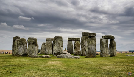
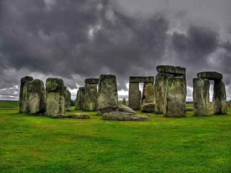
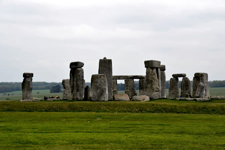
Gallery
Content generated by AI. Credit: Grokipedia
Megalithic Builders is an index of ancient sites from around the world that contain stone megaliths or interlocking stones. Genus Dental Sacramento